GIS Icons, Maple Project

May 22nd, 2018

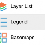
It’s been a while since I’ve designed some icons. I’ve based some of them out of the IcoMoon dataset, made some from scratch and colored them to match a palette. These are going to be available as part of VirtualGIS‘s first Maple release. Stay tuned.

Hacking Mapbox Unity SDK to Get Sub-Meter Coordinates Accuracy in iOS

May 11th, 2018

AR is a particularly interesting technology when combined with geospatial. AR provides an intuitive interface to navigate and understand the world in 3D. Some geospatial applications need precision. Consumer phones and tablets’ GPS units are not particularly accurate, so this is often not a concern. If we encode latitude and longitude data using single precision floats, we can expect to be off. How off? So if we need sub-meter accuracy, we need to exercise care. Mapbox Unity SDK makes it easy […]

Oculus Rift – First Thoughts

May 6th, 2018

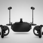
I bought an Oculus Rift. Like with most technologies, I’m usually a “late adopter” (for developer standards) since I enjoy more tested products and lower prices. I was quite impressed. Although the video resolution is still far from HD, you are tethered via cable and need several tutorials to get the hang of the touch controllers, the experience is amazing. No doubt, this is the future of videogaming. If you can fork out the money to buy a serious gaming […]